

How healthy is the River Fromus?
- Deben Climate Centre

- Dec 5, 2025
- 3 min read
As part of our Four Rivers Recovery project, members of Kelsale & District Wildlife Action (KADWAG) and Biodiversity Action Partnership Saxmundham (BAPS), have recently set up a working group for the River Fromus.
The group aims to start regular water monitoring and other observation of the changing river landscape to better understand the Fromus and the challenges it faces.
Read their news bulletin below:
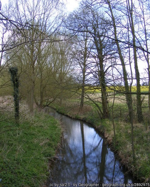
In March, Kelsale & District Wildlife Action (KADWAG) applied for and received enabling funding from our East Suffolk Councillor, Julia Ewart, to kick start our involvement in monitoring the water quality of the River Fromus. This enables us to work with the Biodiversity Action Partnership Saxmundham (BAPS) plus other parish and town councils as part of the East Suffolk Council (ESC) 4 Rivers Recovery project which covers the Rivers Deben, Alde & Ore, Blyth and Waveney.
Using our enabling funding we’ve now bought some of the equipment necessary to do this and have set up a series of monitoring points along the length of the Fromus and its tributaries (see attached map). At these we will monitor the levels of e.coli, ammonia, nitrates and phosphates present in the river so we can identify any pollution and the possible causes, and ways that the health of the river might be improved. Although our series of monitoring points extends the whole length of the Fromus we agreed with the Saxmundham Blue Spaces Team that they will monitor the water quality under the bridge next to Waitrose in Saxmundham and that the Alde & Ore Association will monitor the water quality of the Fromus at Benhall Green ford and at the exit of the sewage works at Aldecar Lane, Benhall.
Both KADWAG and BAPS members have attended water quality testing workshops held by The Deben Climate Centre.
We’re also setting up a series of regular walks along the River Fromus and its tributaries so that we can observe how the river changes over the year, measure the water levels and quality, and identify the vegetation (including any Himalayan Balsam) present. If you’d like to join one of these planned walks please contact Ken Bate on 07745 156142 or email bateken@hotmail.com
We are part of The 4 Rivers Recovery Project.
Proposed Water Quality Monitoring points:
RF01 As near as possible to the source of the Fromus near Coe Wood
RF02 After the Fromus leaves Coe Wood as it enters the Fromus Reserve
RF03 After the Fromus leaves the Fromus Reserve before it enters Kelsale village (to check for effluent from the cattle on the Fromus and from Kelsale Lodge)
RF04 After the Fromus passes through the centre of Kelsale under the bridges (to check for run off from house drains)
RF05 After the entry of water from the Gull Stream (near MP) to check for pollution from Gull stream (previously reported near Sandy Lane)
RF06 After the stream from the Brook Farm estate has entered the Fromus
RF07 Before the Fromus goes under Church Street bridge near Waitrose in Saxmundham (the Sax Blue Spaces Team monitor phosphates and nitrates here)
GS01 Gull Stream at Vale Farm Bridge, Carlton
GS02 Gull Stream between Sandy Lane and footbridge
GS03 Gull Stream near Carlton Church (after land drain pipe)
GS04 Gull Stream near destroyed brick footbridge south of Carlton Industrial Estate (near tyre)
BF01 The Brook (Brook Farm) output from balancing ponds
B01 At the B1121 road bridge in Benhall
B02 At the ford in Benhall (The Alde & Ore Association will monitor here)
B03 At the FB after the sewage works at Benhall Low Street (The Alde & Ore Association will monitor here)
B04 At the FB near Botany Farm, Gromford after possible agricultural run-off


Comments